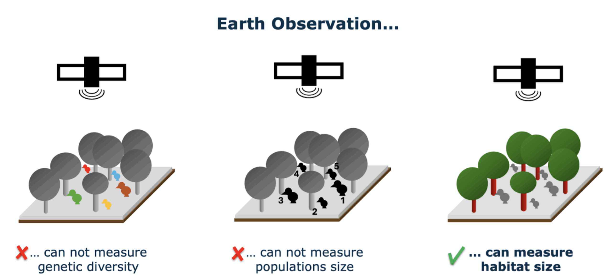
Species genetic diversity is a critical aspect of ecosystem health, but assessing it can be challenging due to the complexity of gathering and analyzing relevant data across large spatial scales. Traditional methods often require extensive fieldwork and labor-intensive sampling for DNA sequencing, which limits the frequency and scale of genetic diversity assessments. The Genes From Space monitoring tool in BON in a Box uses Earth Observations (EO) to track habitat changes over time and infer population trends as indicators of genetic diversity. Leveraging public EO data, the tool enables users to calculate two genetic diversity indicators adopted by the Convention on Biological Diversity:
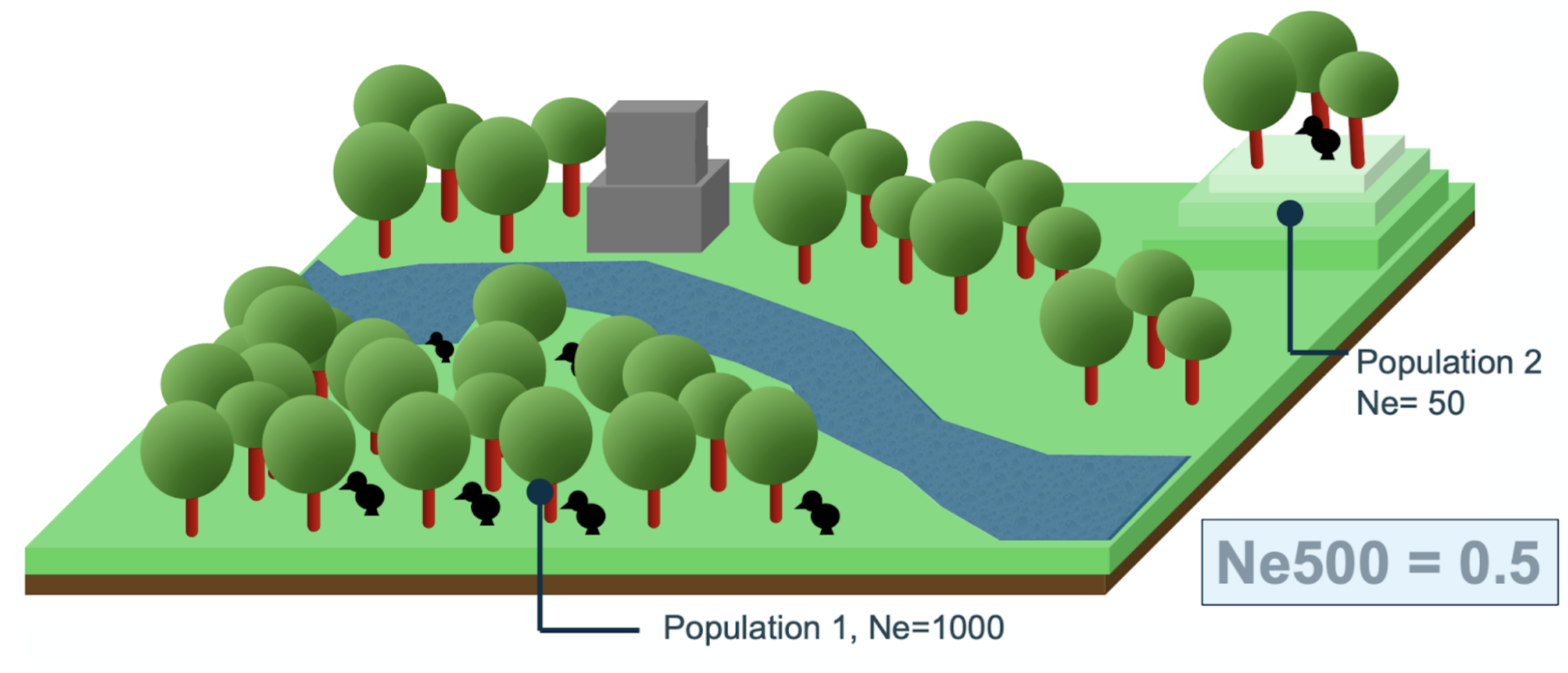
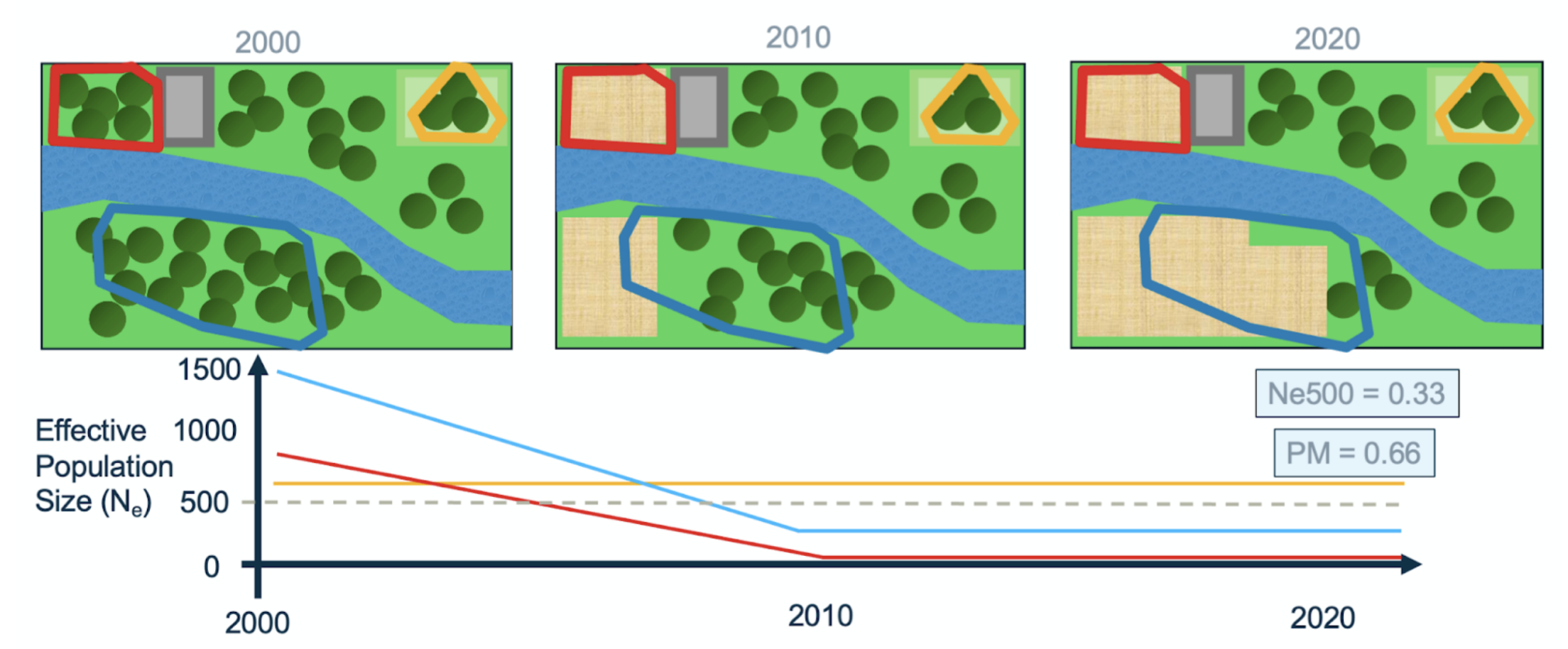
the Ne > 500 indicator, indicating the fraction of populations with an effective population size (Ne) above 500 units. Populations with Ne below 500 units are at risk of genetic erosion. Ne > 500 a headline indicator in the GBF.
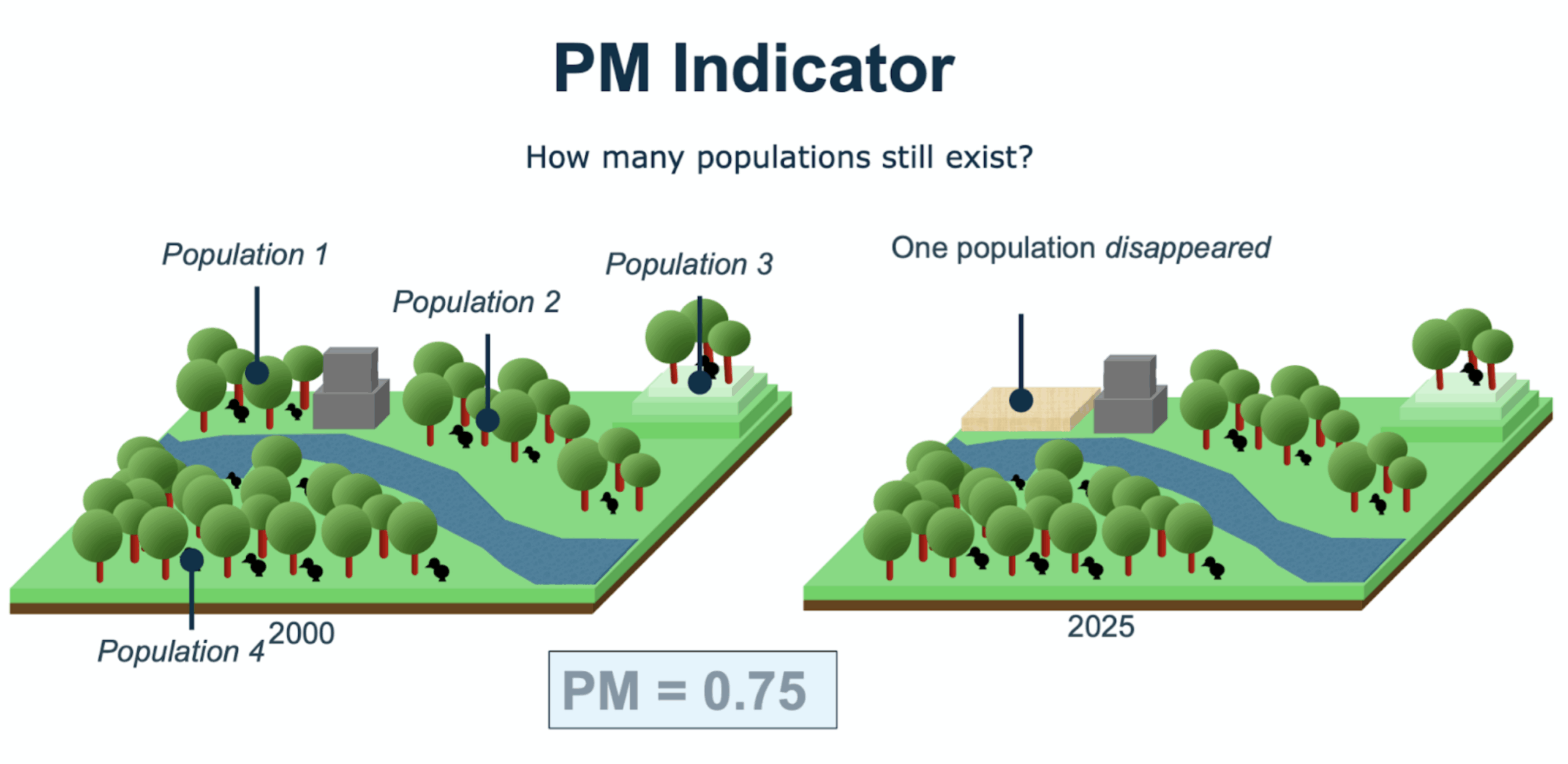
the Populations Maintained indicator (PM), indicating the fraction of populations that are maintained (i.e., did not go extinct) over time. This is a complementary indicator in the GBF.
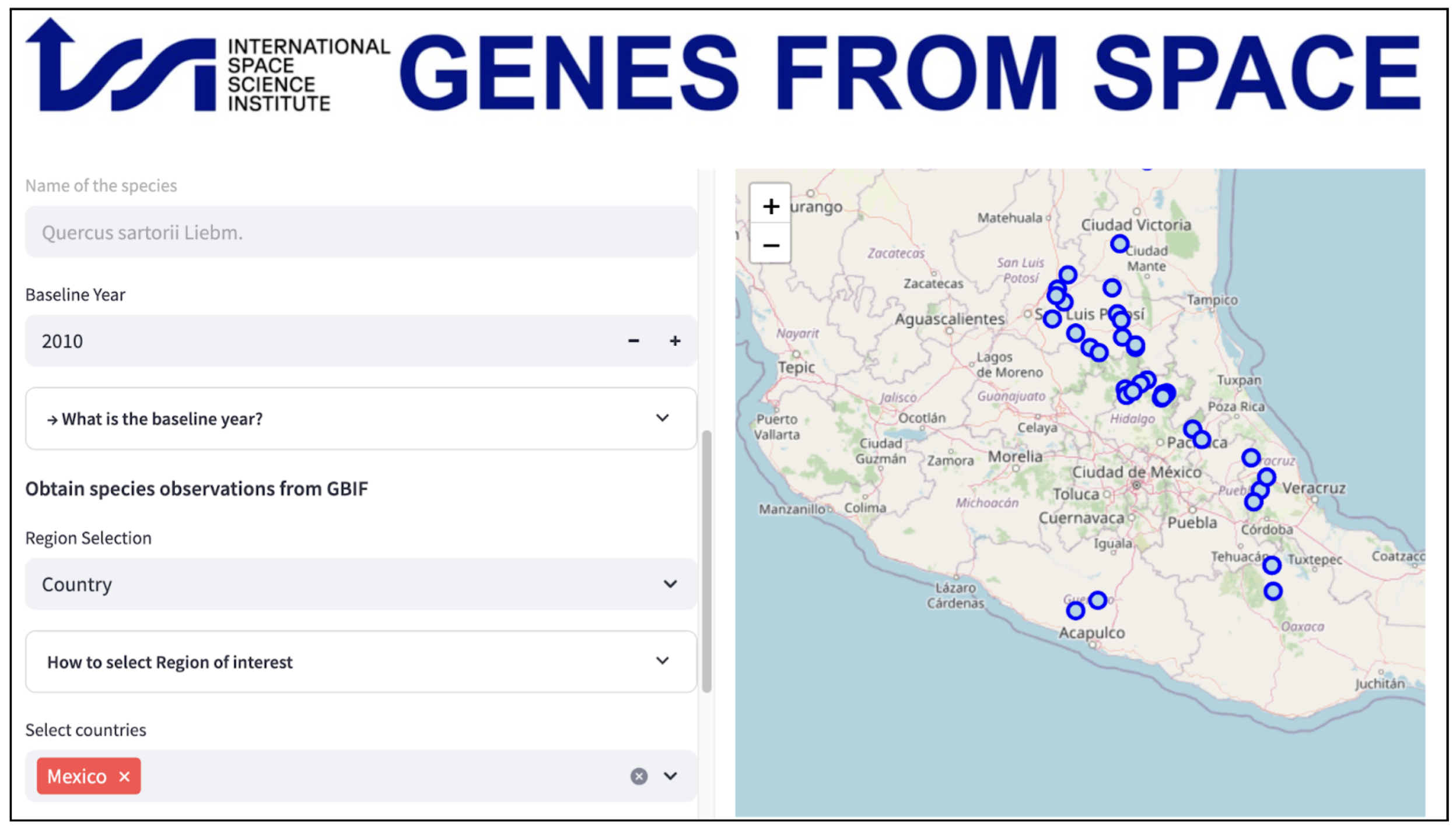
The tool provides an interface that simplifies the process of selecting EO datasets, running analyses, and interpreting genetic diversity indicators. Ultimately, this tool offers a more scalable and accessible solution for researchers, conservationists, and policymakers to monitor and protect biodiversity at local, regional, and global levels.
Methods:
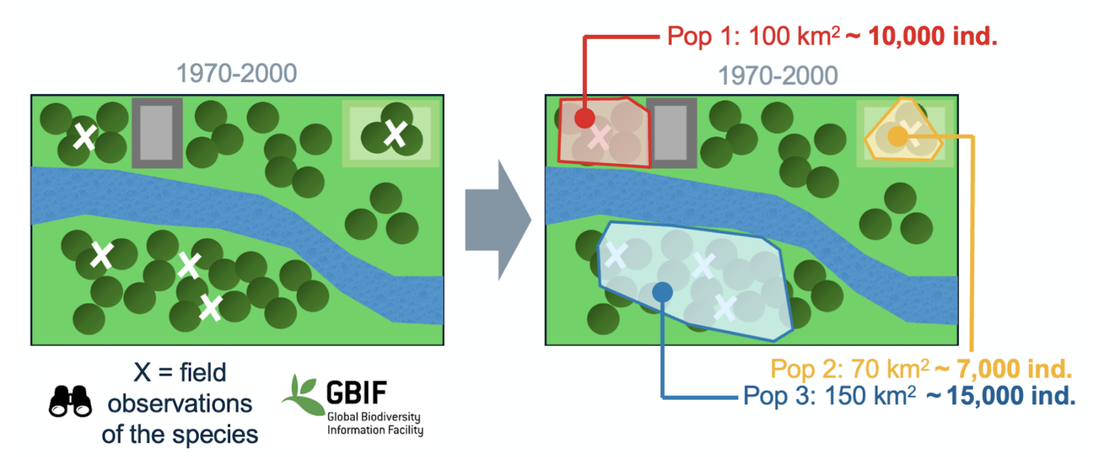
The Tool is made of three components: (1) a population input, which defines the spatial distribution of the species populations; (2) a habitat input, which summarizes changes in the species suitable habitat over time; and, (3) a processing tool that combines population and habitat inputs to calculate genetic diversity indicators. Populations are defined as polygons representing areas where distinct populations can potentially be found. The habitat input is a set of suitability maps describing the area in which the species can realistically exist over time. For example, the habitat map of a forest dwelling species can show areas with tree cover and change over time. The pipeline uses population polygons and habitat suitability maps over time to calculate the habitat size for each population. Habitat size is combined with provided population estimates to calculate the genetic diversity indicators.
BON in a Box Pipelines:
There are several pipelines and sub-pipelines in BON in a Box to calculate the genetic diversity indicators. The pipelines contain the following inputs:
Species names: The user defines the species of interest
Countries: The user provides one or more country for which to calculate the indicator
Population polygons: The user can either input files of known population boundaries, input monitoring data to generate these polygons, or use GBIF occurrences to generate polygons of populations.
Start and end year for GBIF data: If the user is using GBIF data, they can provide the start and end year for which they want to pull occurrences.
Size of buffer: The user specifies the buffer distance for drawing polygons around populations (how much distance between the points and the edge of the polygon).
Distance between populations: The user defines the distance that defines separate populations, based on estimates of dispersal distances.
Habitat types: The user can either use forest cover data from the Global Forest Watch to measure habitat suitability or land cover data from the European Space Agency. If using land cover data, the user also specifies the land cover classes that are suitable for the species.
Years of interest - habitat change: The user specifies the years that they want to measure habitat change and estimate Ne.
Population density: The user inputs the population density based on known population values, or can specify multiple densities. This will be used to estimate population size (Nc).
Ne:Nc ratio estimate: The user specifies the effective population size (Ne) to Nc ratio. This will be used to estimate the Ne for different populations and calculate the Ne>500 indicator.
The pipeline gives the following outputs:
Interactive plot: This is an interactive plot that shows a map of the populations, the Ne for each population over the years of interest, a table of the effective population size over time, and plots of habitat size over time and changes in habitat size over time. The user can highlight different populations on the map to see the values in the plots.
Ne>500 indicator: A number with the Ne>500 indicator, as a proportion of populations with an effective population size greater than 500.
Population maintained indicator: A number with the proportion of populations that are still extant.
Effective population size: A table of effective population sizes over time, that can be downloaded as a TSV.
Contributors:
Oliver Selmoni (oliver.selmoni@gmail.com)
Simon Pahls (simon.pahls@uzh.ch)
Citations:
ESA. Land Cover CCI Product User Guide Version 2. Tech. Rep. (2017). Available at: maps.elie.ucl.ac.be/CCI/viewer/download/ESACCI-LC-Ph2-PUGv2_2.0.pdf
Hansen, M. C., Potapov, P. V., Moore, R., Hancher, M., Turubanova, S. A., Tyukavina, A., Thau, D., Stehman, S. V., Goetz, S. J., Loveland, T. R., Kommareddy, A., Egorov, A., Chini, L., Justice, C. O., & Townshend, J. R. G. (2013). High-Resolution Global Maps of 21st-Century Forest Cover Change. Science, 342(6160), 850–853. https://doi.org/10.1126/science.1244693
Schuman, M. C., Röösli, C., Mastretta-Yanes, A., Helfenstein, I. S., Vernesi, C., Selmoni, O., Millette, K. L., Tobón-Niedfeldt, W., Albergel, C., Leigh, D., Hebden, S., Schaepman, M. E., Laikre, L., & Asrar, G. R. (2024). Genes from space: Leveraging Earth Observation satellites to monitor genetic diversity. https://ecoevorxiv.org/repository/view/7274/